2026 — Remote sensing · GISVIEW MAP →
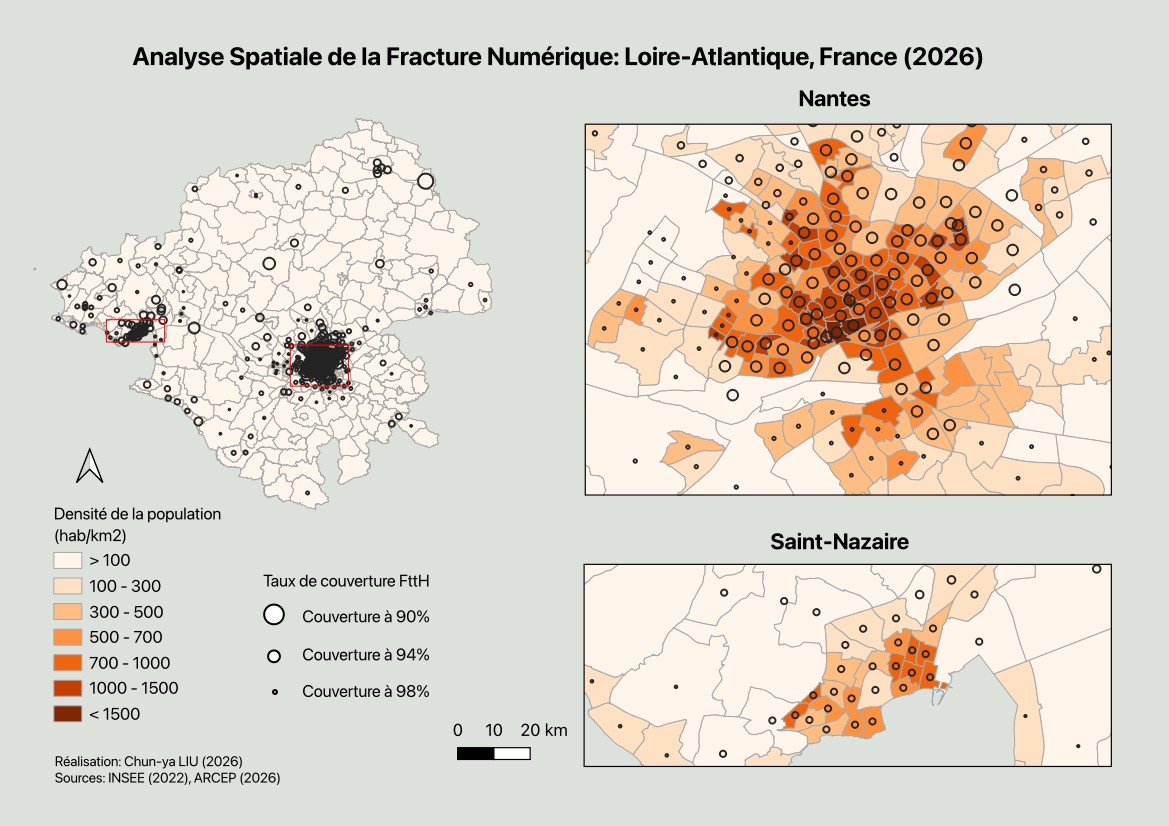
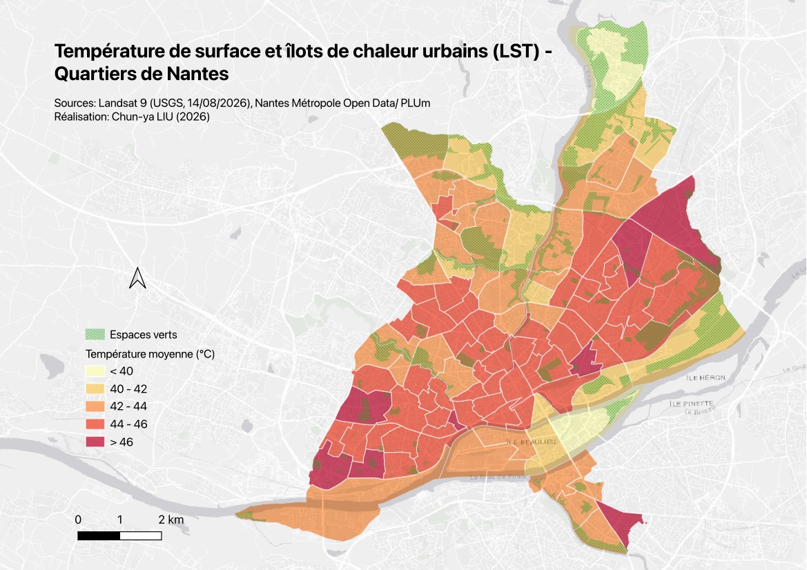
Urban Heat Island in Metropolitan Nantes: From Satellite Imagery to Neighbourhood Microclimate Indicators
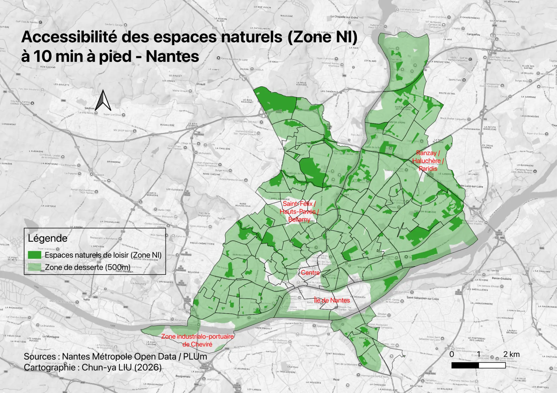
Landsat 9 imagery and IRIS block statistics reveal surface temperatures during the 2026 heatwave and the cooling effect of blue-green infrastructure.