C-Y. Esther LIU

( 01 ) — SPATIAL NARRATIVE

Reading cities as layered terrain, one contour at a time.

Distilling the complex weave of population, land, and spatial movement into clear, simple stories and maps to inform decision-making.

12
Years mapping
40+
Maps shipped
3
Working langs
NOTEBOOKCITY · PLANNING · LIFE

( 02 ) — SELECTED WORK

Maps that carry a decision.

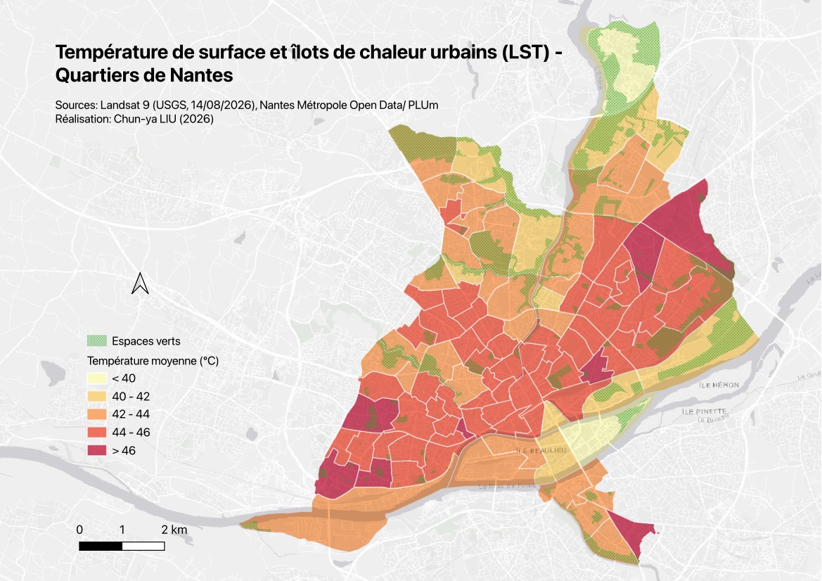
Urban Heat Island in Metropolitan Nantes: From Satellite Imagery to Neighbourhood Microclimate Indicators — Heat island · Remote sensing
2026 — Remote sensing · GIS

Urban Heat Island in Metropolitan Nantes: From Satellite Imagery to Neighbourhood Microclimate Indicators

Landsat 9 imagery and IRIS block statistics reveal surface temperatures during the 2026 heatwave and the cooling effect of blue-green infrastructure.
Accessibility of Recreational Green Spaces in Nantes: The 10-Minute Walking City and Its Blind Spots — Green space · GIS
2026 — GIS

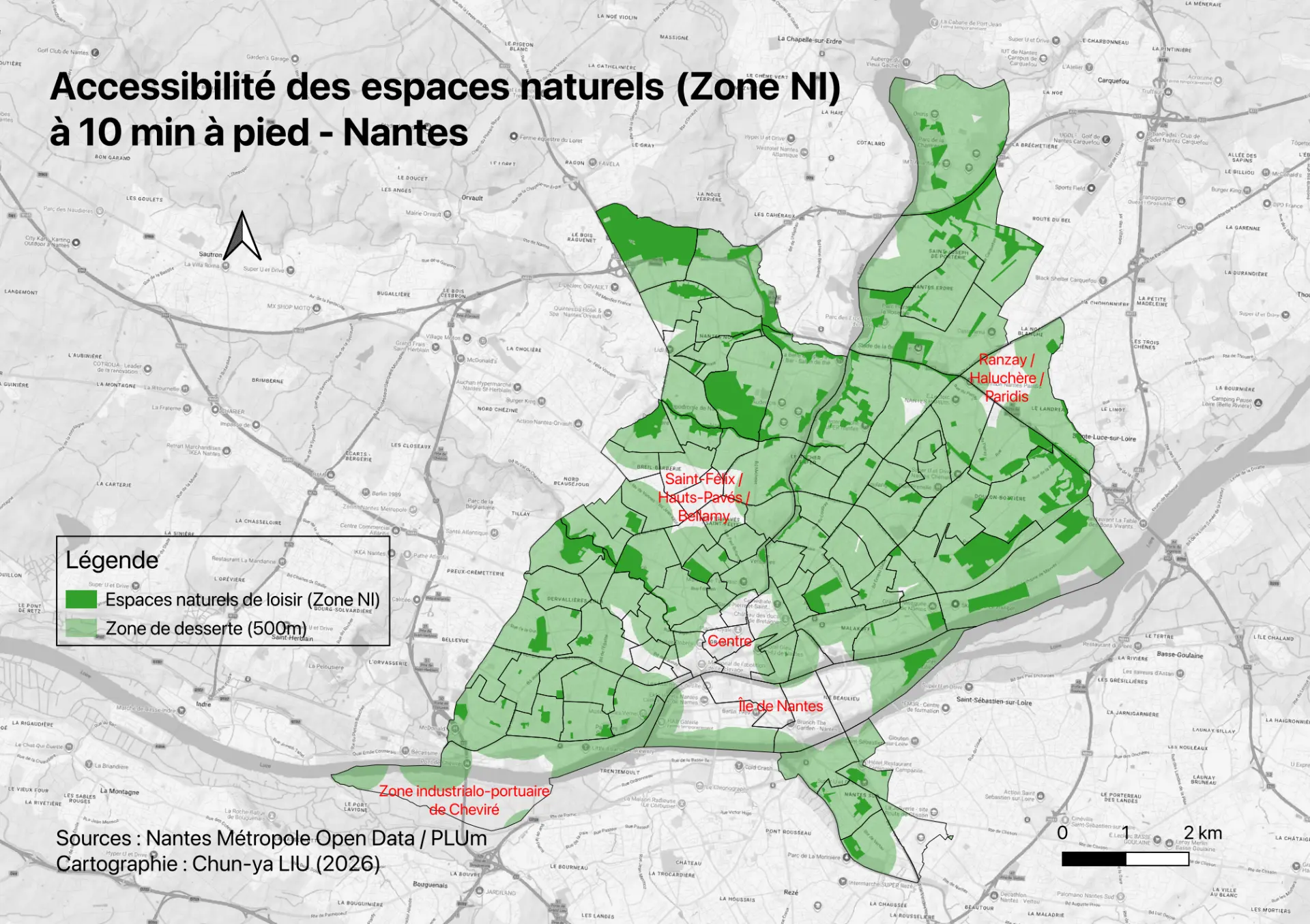
Accessibility of Recreational Green Spaces in Nantes: The 10-Minute Walking City and Its Blind Spots

Can Nantes residents reach a public leisure green space within a 10-minute walk? Mapping coverage and four kinds of blind spot.

Cycling–Transit Intermodality Analysis — GIS
2026 — GIS

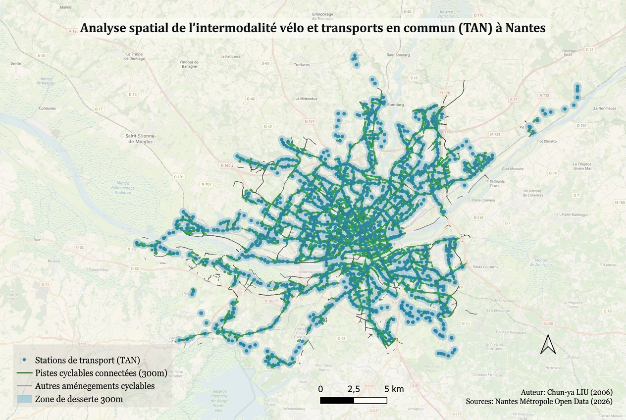
Cycling–Transit Intermodality Analysis

300-metre interchange coverage between cycle routes and TAN stops across Nantes Métropole.

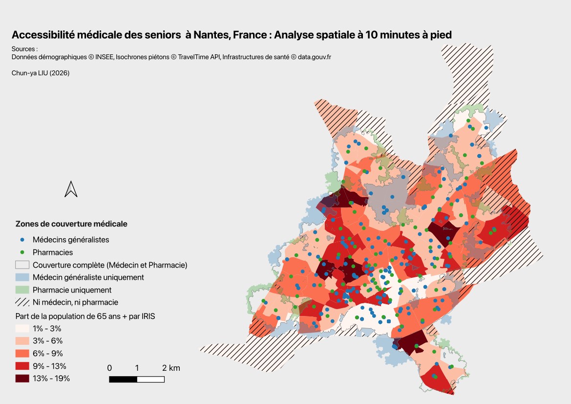
Senior healthcare accessibility in Nantes — GIS
2026 — GIS

Senior healthcare accessibility in Nantes

Doctors, pharmacies and older residents within a 10-minute walk.

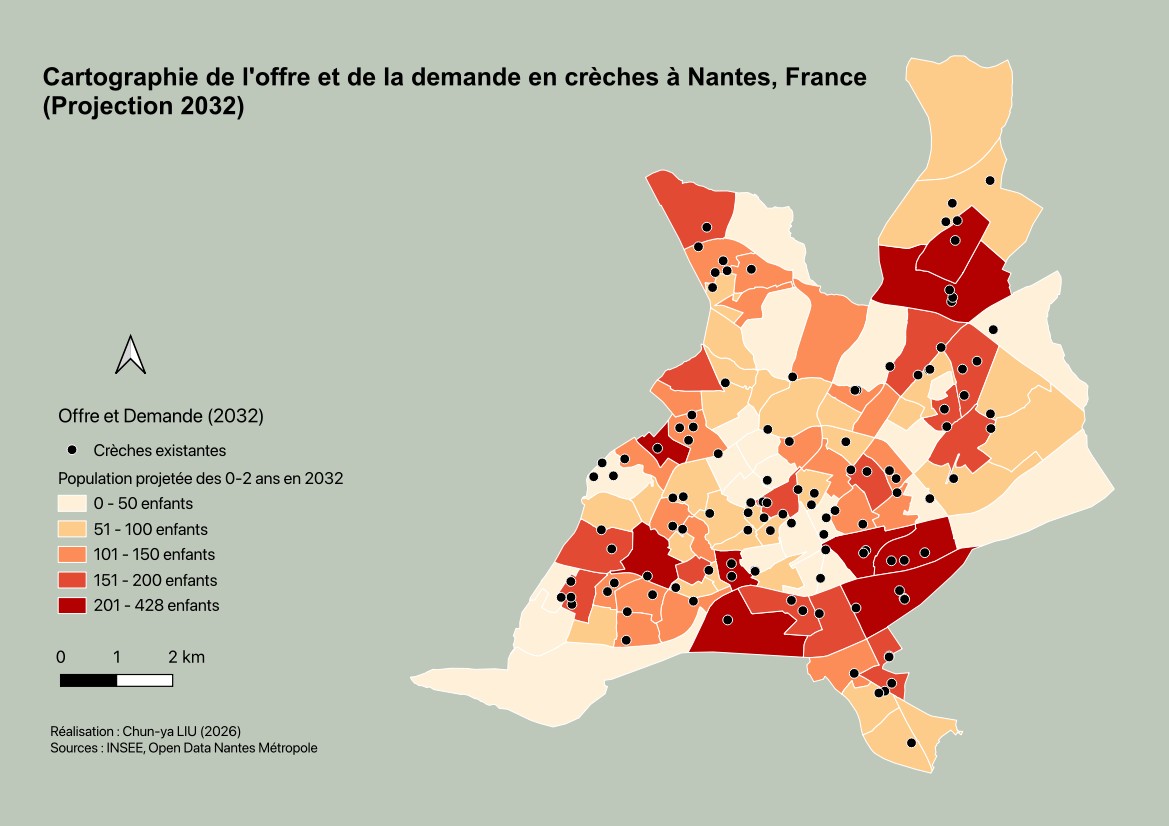
Childcare supply and demand in Nantes, 2032 — GIS
2026 — GIS

Childcare supply and demand in Nantes, 2032

Spatial gaps between existing crèches and projected demand among children aged 0–2.

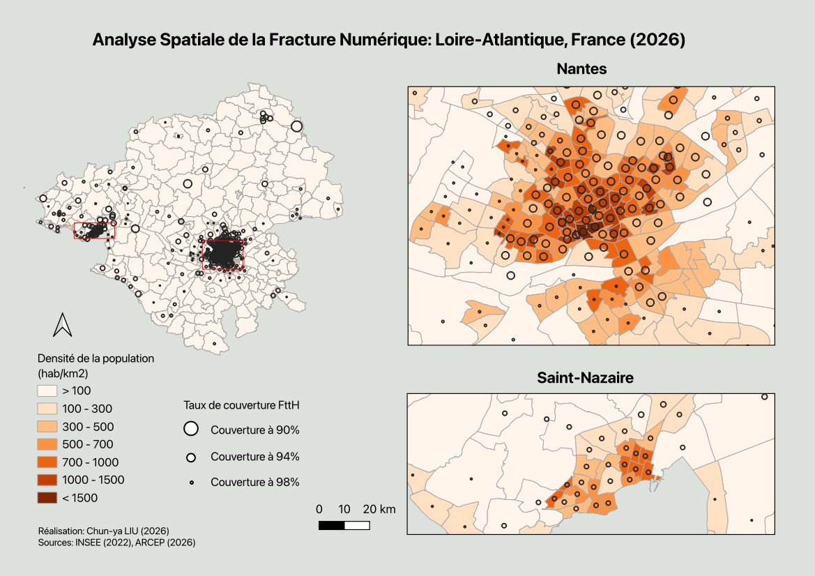
Spatial Analysis of the Digital Divide — GIS
2026 — GIS

Spatial Analysis of the Digital Divide

Fibre coverage × population density in Loire-Atlantique.

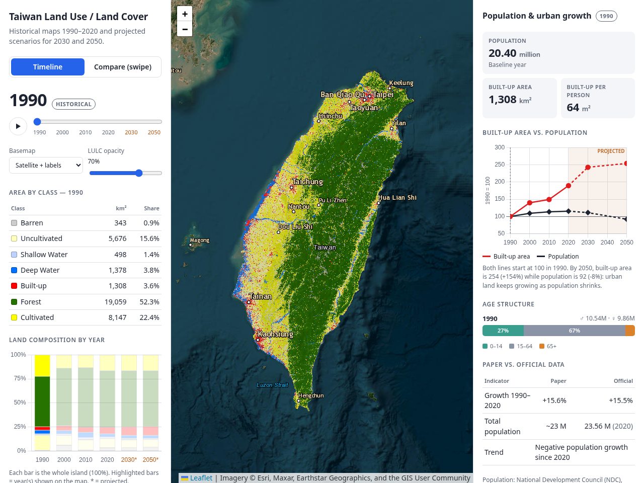
Foreseeing Taiwan's Future: Machine Learning and Remote Sensing for Land Change Analysis (1990–2050) — Land change · Remote sensing
2024 — Remote sensing · Machine learning

Foreseeing Taiwan's Future: Machine Learning and Remote Sensing for Land Change Analysis (1990–2050)

Landsat imagery and machine learning trace 30 years of land change in Taiwan and simulate 2030 and 2050.

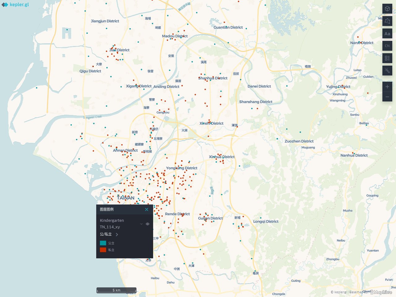
Seeing Quality Early Education: An Interactive Kindergarten Finder for Tainan and Its Future — GIS
2026 — GIS · PYTHON

Seeing Quality Early Education: An Interactive Kindergarten Finder for Tainan and Its Future

An interactive map of public and private kindergartens across Tainan, with locations and contact details.

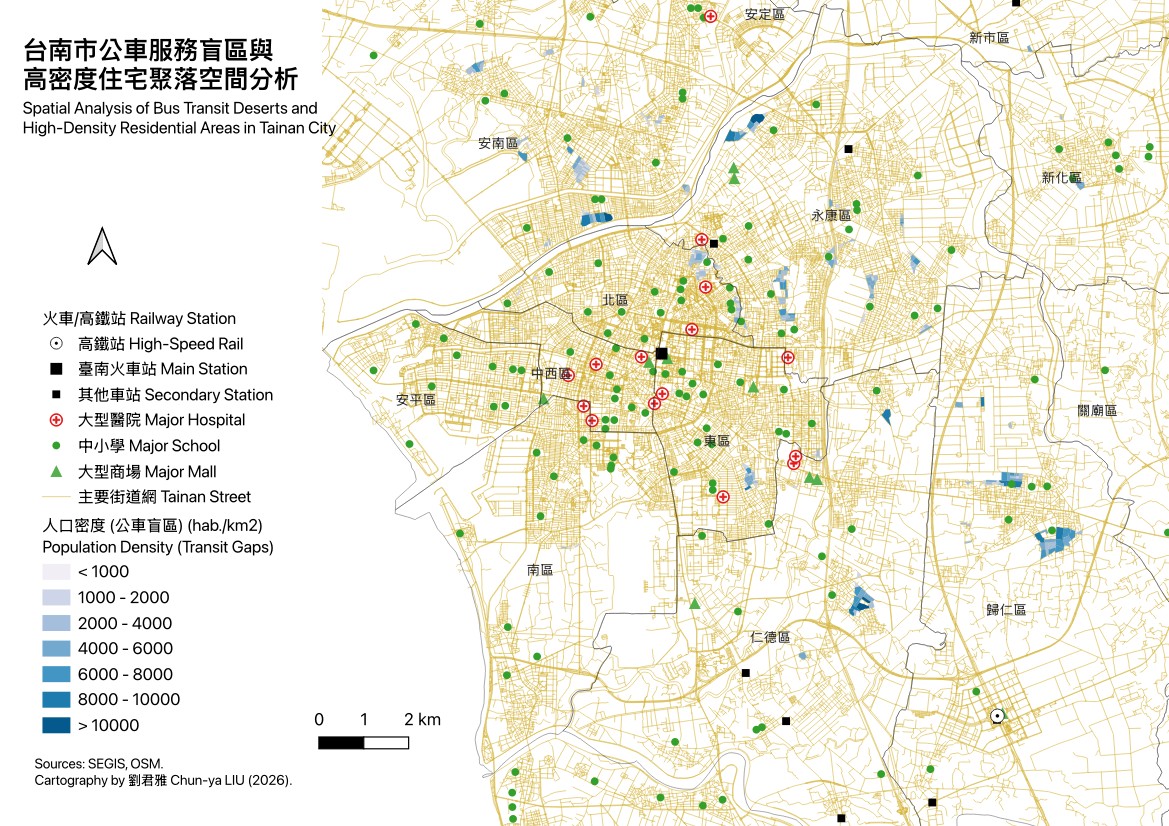
Bus transit deserts in Tainan City — GIS
2026 — GIS

Bus transit deserts in Tainan City

Locating high-density residential neighbourhoods left beyond the reach of the existing bus network.

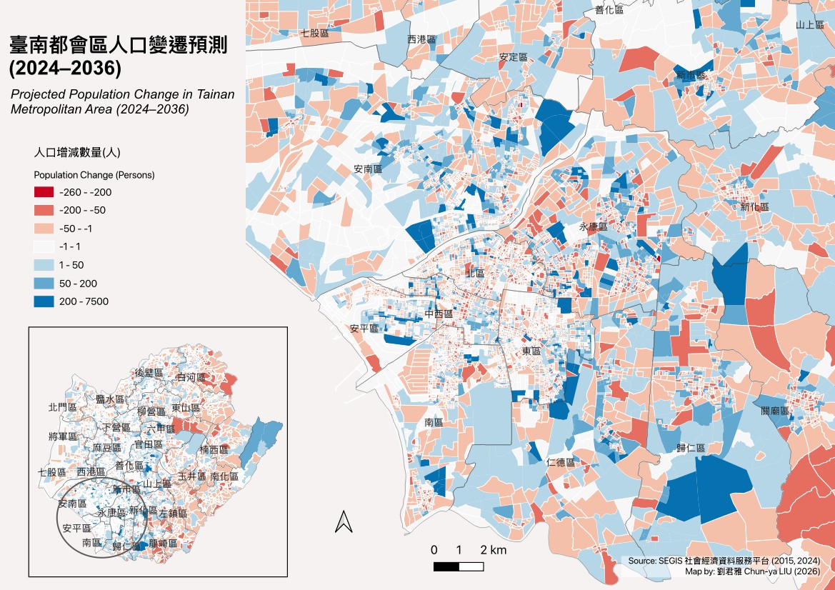
Projected population change in Tainan, 2024–2036 — GIS
2026 — GIS

Projected population change in Tainan, 2024–2036

A shrinking old city and a polarising new one: where Tainan loses and gains residents.

( 03 ) — PROFILE

Chun-ya LIU, PhD

SOCIO-ECONOMIC STUDIES & GIS SPECIALIST

From Tainan, Taiwan, and living in France for over 15 years, with a PhD in land planning, masters in demography and geography, as well as in national development. I specialise in online platform building and database management, cartographic analysis, AI spatial model training and GIS technical training — and I am dedicated to applying spatial-analysis methods in socio-economic research.

BASED — NANTES, FR EU LONG-TERM RESIDENT

LANGUAGES

  • Chinese · TaiwaneseZH · NATIVE
  • FrenchFR · FLUENT
  • EnglishEN · IELTS 6.5

EXPERIENCE

  1. GeoAI Spatial Data Specialist — Scale AI (Remote)

    2026

    Geospatial AI & LLM Alignment (RLHF): Evaluated, fine-tuned, and benchmarked generative AI and frontier models, with a specialized focus on spatial reasoning, geostatistics, and GIS workflows.

  2. Geo-statistician — Gérontopôle des Pays de la Loire

    2023 — 2025

    Built and ran Cart'âge, an online mapping platform and territorial database on ageing — grown from nothing to 2,200+ indicators. Trained 50+ public-sector users and published regular regional demographic analyses.

    cart-age.gerontopole-paysdelaloire.fr ↗
  3. Mandarin Lecturer — Université Lumière Lyon 2

    2015–2017 · 2020–2022

    Taught simplified Chinese to French university students, 200 hours per year.

  4. Doctoral Researcher — Ministry of Education, Taiwan (Grant)

    2017 — 2020

    Research on Taiwan's urban development: political regimes, economic development and urban growth. PhD thesis in Geography, supervised by Natacha Aveline — Université Paris 1 Panthéon-Sorbonne, 2020.

    theses.fr/2020PA01H015 ↗

EDUCATION

  • PhD, Land PlanningUniversité Paris 1 Panthéon-Sorbonne

    2014–2020
  • M2 GeographyUniversité Paris Cité

    2012–2013
  • M2 DemographyUniversité Paris Cité

    2011–2012
  • MA National DevelopmentNational Taiwan University

    2005–2008
  • BA Public AdministrationNational Chi Nan University

    2002–2005
  • Associate Degree in FrenchWenzao Ursuline University of Languages

    1997–2002

TECHNICAL SKILLS

GIS & REMOTE SENSING

QGIS (Expert)ArcGISGeoDaGoogle Earth Engine

DATABASES & PROGRAMMING

SQL (PostgreSQL/PostGIS)RPythonAdvanced Excel

WEB MAPPING & DATAVIZ

LovableReactTableauPower BIGéoclip

GRAPHIC DESIGN

Adobe IllustratorPhotoshopCanva

PUBLICATIONS